Tagged with maps
un-united states
Posted February 28th, 2011 at 6:37 pm. There are 0 comments.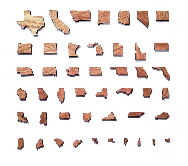
via Mark Weavers flickr
new york city department of transportation pothole blog
Posted February 18th, 2011 at 4:39 pm. There are 0 comments.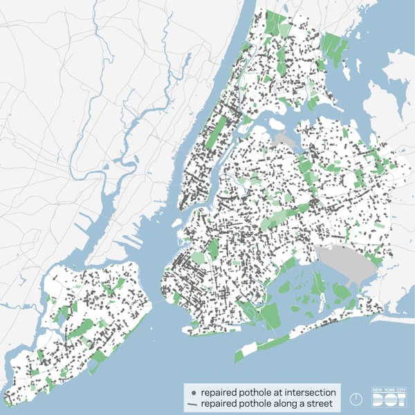
All the potholes fixed in the last month, from January 16 to February 15
the daily pothole features daily counts of potholes fixed and lots of action shots of potholes getting repaired. potholes.
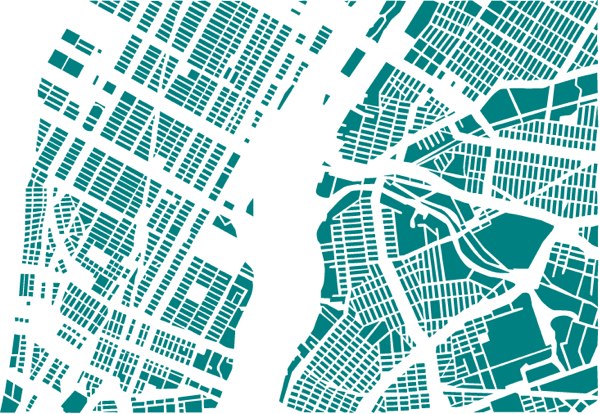
cities reorganized
Posted February 9th, 2011 at 1:48 pm. There are 0 comments.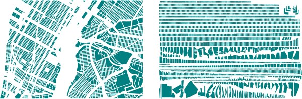
French artist Armelle Caron deconstructs city maps and reorganizes them into neat and tidy rows.

8-bit cities
Posted February 4th, 2011 at 1:22 pm. There are 0 comments.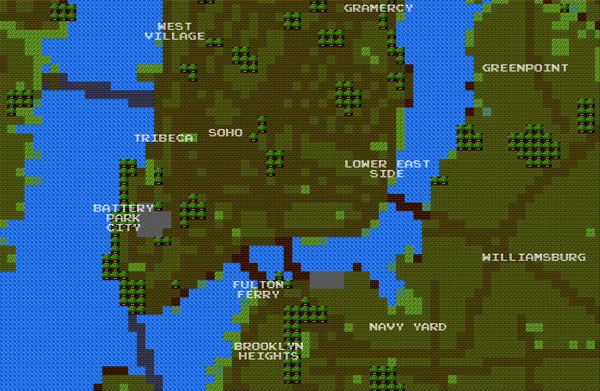
8-bit City is an awesome Kickstarter funded project by Brett Camper. Videogame graphic inspired slippy maps built on top of Openstreetmap data.
The 8-Bit Cities project, which started with 8-Bit NYC, is an attempt to make the city feel foreign yet familiar, smashing together two culturally common models of space: the lo-fi overhead world maps of 1980s role-playing and adventure games, and the geographically accurate data that drives today’s web maps and GPS navigation. I hope to evoke the same urge for exploration, abstract sense of scale, and perhaps most importantly unbounded excitement that many of us remember experiencing on the Nintendo Entertainment System, the Commodore 64, or any other number of 8-bit microcomputers. Maps offer us visual architectures of the world, encouraging us to think about and interact with space in particularly constrained ways. Take some time to think about your surroundings a little differently. Set out on a quest. Be an adventurer
is this the new google maps ui
Posted December 3rd, 2010 at 5:33 pm. There are 0 comments.Check out that sweet ‘other’ view option window in the upper right.
via 41 latitude
maps of luis dourado
Posted November 29th, 2010 at 3:38 pm. There are 0 comments.
Untitled Map #3 by Luis Douradro
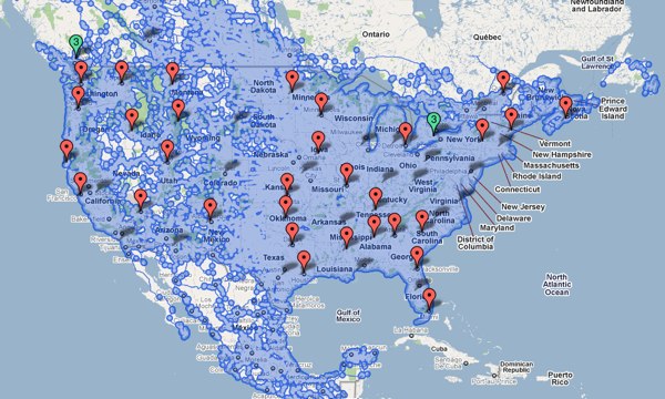
google street view coverage
Posted November 15th, 2010 at 10:27 pm. There are 0 comments.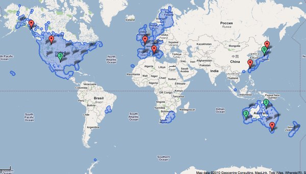
Google map showing all areas covered by Street View
the paranoia of finding oneself on a trap street
Posted October 28th, 2010 at 2:47 pm. There are 0 comments.
BLDGBLOG posits some possible futures of trap rooms which are the architectural equivalent of a trap street in the context of in the of interior mapping of shopping malls and the like. A trap street (examples) is a
deliberate cartographic error introduced into a map so as to catch acts of copyright infringement by rival firms.
So you put deliberately false information into your cartographic work and then monitor the maps created by competitors and watch for your honeypot cartographic features to show up on work they claim to be their own. As mentioned in the post, as the mapping of interior space becomes more widespread the introduction of trap rooms, trap corridors, trap stair etc will become commonplace as firm seek to protect their work and the deals they have made for the interior geo-data. In turn, people we be left wondering how to occupy the spaces they see in some of their maps, but not others. The best bit comes at the end,
But I’m also curious about less practical things, such as what cultural, even psychological, effects the presence of trap rooms might actually have. Games could be launched, the purpose of which is to find and occupy as many trap rooms as possible. New paranoias emerge, that the room featured above your apartment on that new app you just downloaded is not really there at all; it’s a trap room, and you can’t sleep at night, worried that you actually have no neighbors, that you’re the last person on earth and every building around you is a dream. There are panic attacks by people walking home alone at 3am when they become overwhelmed with the suspicion that they are actually walking inside a trap hall—a corridor that has never been real—losing consciousness and falling to the ground as irrational fears become too much for them.
round things
Posted October 25th, 2010 at 11:24 am. There are 0 comments.
Approximately 1,376 Silos, Water Towers, and other Cylindrical-Industrial Buildings
by Jenny Odell
Be sure to check out the other satellite collections as well the ministry of approximate travel
what is approximate traveling? In order to travel approximately, I made use of any source of information I could find online, relying especially on Google Street View, photo databases (Panoramio, Picasa, Flickr), review sites (Yelp, TripAdvisor, CitySearch, Insider Pages), and virtual tours of monuments, restaurants, hotels, etc. I transported myself into one place after another, both by writing a travel narrative and by superimposing myself onto photos I found online. The people I “met” were disgruntled hotel reviewers, restaurant ravers, and anyone who took the time to upload their story in one form or another to a site like Google Maps.
Google maps with just the placenames
Posted September 1st, 2010 at 7:36 pm. There are 0 comments.
Fata Morgana by Damon Zucconi
[ iamtheweather powered by Wordpress And is definitely Not Plastic Bag ]