In the Category grid of things
mit media lab gets a new identity
Posted March 7th, 2011 at 10:07 pm. There are 0 comments.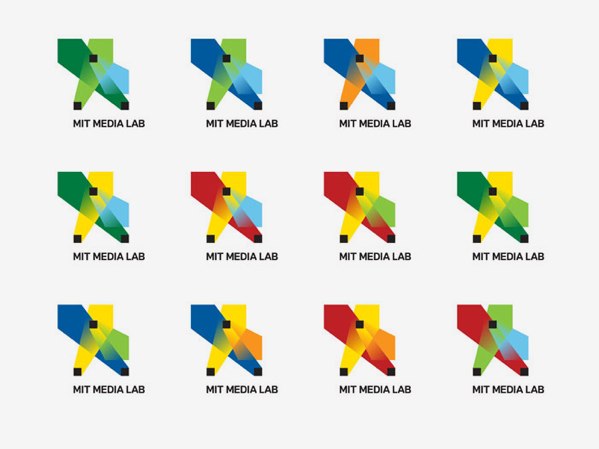
The logo is based on a visual system, an algorithm that produces a unique logo for each person, for faculty, staff and students. Each person can claim and own an individual shape and can use it on their business card a personal website. The design encompasses all collateral, business cards, letterhead, website, animations, signage etc. A custom web interface was developed to allow each person at the Media Lab to choose and claim an own individual logo for his/her business card, as well as a custom animation software which allows to create custom animations for any video content the lab produces.
See the system in action in a little video
Designed by E Roon Kang in collaboration with TheGreenEyl
architects
Posted March 4th, 2011 at 8:49 pm. There are 0 comments.
The All Nighter has simplified famous architects quite a bit. I love this.
van gogh paintings
Posted March 4th, 2011 at 11:14 am. There are 0 comments.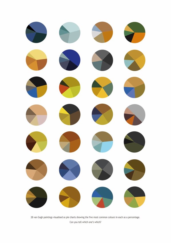
Van Gogh paintings as pie charts by Arthur Buxton
pixelated cameras
Posted March 3rd, 2011 at 4:19 pm. There are 0 comments.![]()
BillyBrown made this awesome set of pixelated camera and photo stuff. #winning
un-united states
Posted February 28th, 2011 at 6:37 pm. There are 0 comments.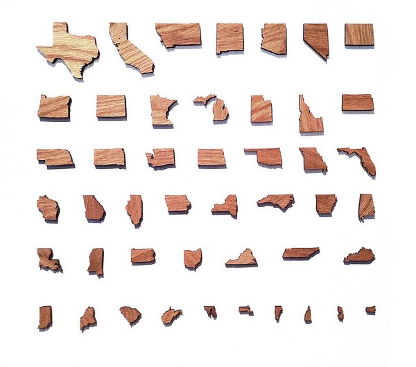
via Mark Weavers flickr
pins
Posted February 27th, 2011 at 4:58 pm. There are 0 comments.
Tara Donovan is without a doubt one of my favorite artists.
![Tara Donovan_s Brilliant Drawings Made of Thousands of Pins [Slideshow] | Co.Design.jpg](http://iamtheweather.com/vveather/wp-content/uploads/2011/02/Tara-Donovan_s-Brilliant-Drawings-Made-of-Thousands-of-Pins-Slideshow-Co.Design.jpg)
Her Pins series at Pace Gallery is nearly made just for me. Gradients tediously constructed from the density of the heads of straight pins stuck in giant board. I’m in love.
consumed
Posted February 14th, 2011 at 4:35 pm. There are 0 comments.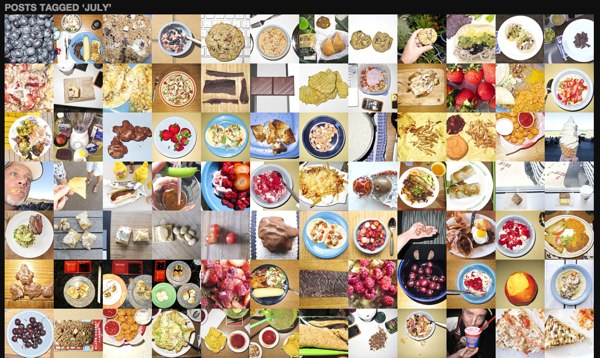
For a year in 2010, Bill Rugan took a photo of everything he ate, and created a “Catalogue of Everything I Ate”
This is not a blog. This is a catalogue. A compendium of all the things I stuffed into my stupid face during 2010. Every meal, snack, nosh, or scrap I consumed. Seconds? Yes. A cracker? Yep. A single pistachio found in the bottom of the bowl that did not need to be shelled? You betcha.
I noticed that food and circular shapes go well together.
mutatoes
Posted February 10th, 2011 at 11:57 am. There are 0 comments.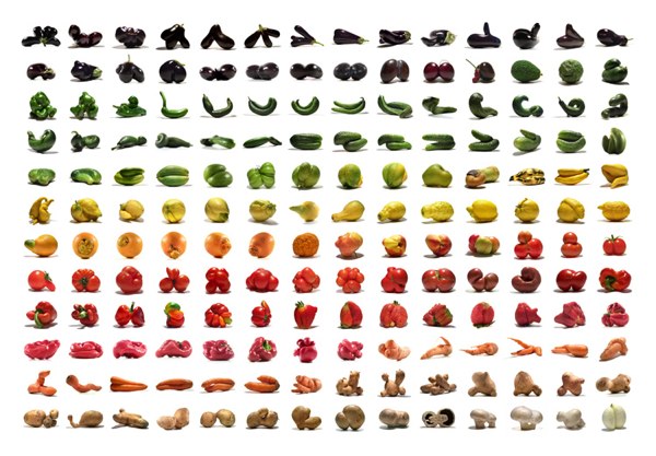
Uli Westphal’s mutant vegetables, or Mutatoes
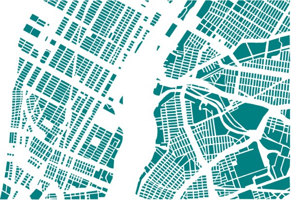
cities reorganized
Posted February 9th, 2011 at 1:48 pm. There are 0 comments.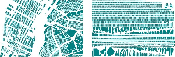
French artist Armelle Caron deconstructs city maps and reorganizes them into neat and tidy rows.

8-bit cities
Posted February 4th, 2011 at 1:22 pm. There are 0 comments.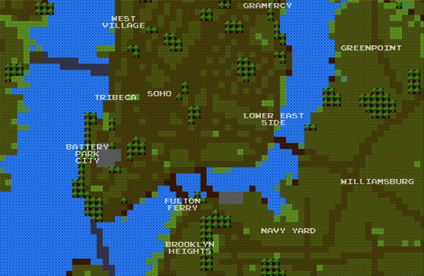
8-bit City is an awesome Kickstarter funded project by Brett Camper. Videogame graphic inspired slippy maps built on top of Openstreetmap data.
The 8-Bit Cities project, which started with 8-Bit NYC, is an attempt to make the city feel foreign yet familiar, smashing together two culturally common models of space: the lo-fi overhead world maps of 1980s role-playing and adventure games, and the geographically accurate data that drives today’s web maps and GPS navigation. I hope to evoke the same urge for exploration, abstract sense of scale, and perhaps most importantly unbounded excitement that many of us remember experiencing on the Nintendo Entertainment System, the Commodore 64, or any other number of 8-bit microcomputers. Maps offer us visual architectures of the world, encouraging us to think about and interact with space in particularly constrained ways. Take some time to think about your surroundings a little differently. Set out on a quest. Be an adventurer
[ iamtheweather powered by Wordpress And is definitely Not Plastic Bag ]