In the Category mapping
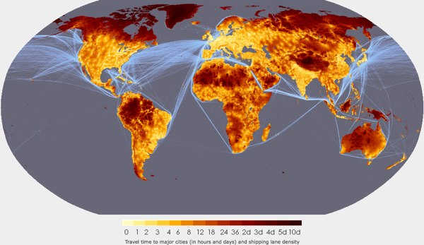
Travel time to major cities: A global map of Accessibility – European Commission
Posted January 6th, 2009 at 1:45 pm. There are 0 comments.
It is amazing that we can get to nearly anywhere on earth in a matter of hours or a few days. Remoteness is is slipping away.
via: Travel time to major cities: A global map of Accessibility
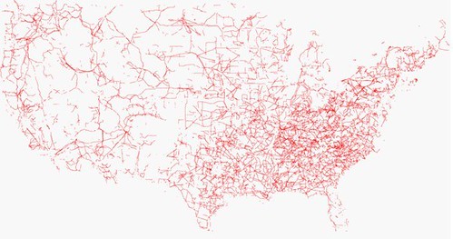
United States in Powerlines
Posted June 19th, 2008 at 10:54 am. There are 0 comments..flickr-photo { border: none } .flickr-yourcomment { } .flickr-frame { text-align: left; padding: 3px; } .flickr-caption { font-size: 0.8em; margin-top: 0px; }
follow the red line navigation
Posted December 19th, 2007 at 9:38 am. There are 0 comments.
Virtual Cable technology that draws route information in an augmented reality display. The 3 dimensional display is created with lasers and mirrors (didn’t fully read that section) and is generated from standard route information output by numerous GPS and SatNav systems available today. The remarkable part about it is the simplicity of the system. “Follow the red line around until we tell you to stop.” The danger may be, as we have seen before, that the information is followed blindly, although keeping ones eyes on the road, and slightly above it, may be better for safety than trying to focus on small map screens, or to decipher the robo-voice directions to bear left in point-five-two miles.
[ iamtheweather powered by Wordpress And is definitely Not Plastic Bag ]
