In the Category geo
Shifting Boundries
Posted January 19th, 2009 at 3:54 pm. There are 0 comments.Since seeing this first post on the Shape of Alpha on the code.flickr blog many many weeks ago I have thought about what it means nearly everyday. Future geographical boundries are becoming more flexible as we define them with our metadata. We are where we think we are, even if that particular there isn’t exactly right. These zones are the questionable locales located between conventional boundries as defined by geographical coordinates recorded in maps and property deeds and the line we have drawn for ourselves, collectively, where once place ends and another begins.
2008 edits at OpenStreetMap.org
Posted January 7th, 2009 at 5:42 pm. There are 0 comments.
OSM 2008: A Year of Edits from ItoWorld on Vimeo.
Very nice animation showing the activity on the maps at OpenStreetMap.org
If you look closely you can see the edits I made in Jersey City last year.
The Mobile City on The Situationists
Posted December 23rd, 2008 at 10:11 am. There are 0 comments.What struck me was that locative media practitioners often refer back to the situationists as some kind of ancestors, as if they’re working in the same vein. The situationist love for traipsing about town is shared by locative artists who similarly enjoy taking computing ‘outside’, into ‘everyday life’. Just like the situationists we must reclaim the street, and this time we’ll use computers to do it!
But that, to me, seems to be where the similarities end. As alive-and-kicking situationist muse Jacqueline de Jong pointed out during the evening, the situationists wanted one thing above all else: to destroy and disrupt our cushy society. They were sick of it, vowing never to work a day in their lives. They probably would have laughed if they had seen that their ideas had been cherry-picked for ripe concepts. The derive, the detournement. All simple concepts that they purposefully packaged in complex and artistc jargon. And we fell for it.
So, we have two options. Either we stop pretending the situationists are our forefathers, or we actually do see them as our forefathers, and start using computing to disrupt instead of streamline society.
Locative Media and The Situationists – The Mobile City
street view coverage maps
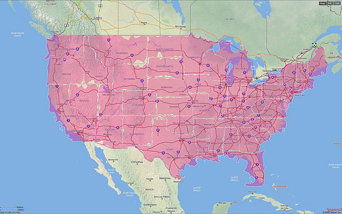
Posted December 9th, 2008 at 6:07 pm. There are 0 comments.Google updated Street View in the US today and have expanded the coverage quite a bit. What used to be a series of small puffy blue clouds covering mostly metropolitan areas has now become are sea of blue covering much of the nation.

After

Before
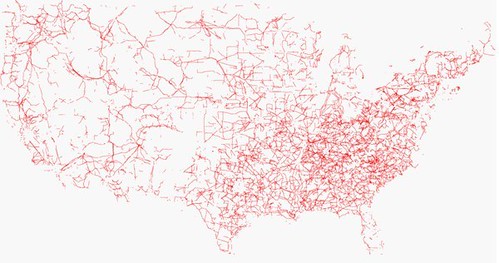
United States in Powerlines
Posted June 19th, 2008 at 10:54 am. There are 0 comments..flickr-photo { border: none } .flickr-yourcomment { } .flickr-frame { text-align: left; padding: 3px; } .flickr-caption { font-size: 0.8em; margin-top: 0px; }
follow the red line navigation
Posted December 19th, 2007 at 9:38 am. There are 0 comments.
Virtual Cable technology that draws route information in an augmented reality display. The 3 dimensional display is created with lasers and mirrors (didn’t fully read that section) and is generated from standard route information output by numerous GPS and SatNav systems available today. The remarkable part about it is the simplicity of the system. “Follow the red line around until we tell you to stop.” The danger may be, as we have seen before, that the information is followed blindly, although keeping ones eyes on the road, and slightly above it, may be better for safety than trying to focus on small map screens, or to decipher the robo-voice directions to bear left in point-five-two miles.
[ iamtheweather powered by Wordpress And is definitely Not Plastic Bag ]

