Tagged with openstreetmap
8-bit cities
Posted February 4th, 2011 at 1:22 pm. There are 0 comments.
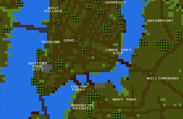
8-bit City is an awesome Kickstarter funded project by Brett Camper. Videogame graphic inspired slippy maps built on top of Openstreetmap data.
The 8-Bit Cities project, which started with 8-Bit NYC, is an attempt to make the city feel foreign yet familiar, smashing together two culturally common models of space: the lo-fi overhead world maps of 1980s role-playing and adventure games, and the geographically accurate data that drives today’s web maps and GPS navigation. I hope to evoke the same urge for exploration, abstract sense of scale, and perhaps most importantly unbounded excitement that many of us remember experiencing on the Nintendo Entertainment System, the Commodore 64, or any other number of 8-bit microcomputers. Maps offer us visual architectures of the world, encouraging us to think about and interact with space in particularly constrained ways. Take some time to think about your surroundings a little differently. Set out on a quest. Be an adventurer
subway sparklines
Posted May 9th, 2009 at 4:18 pm. There are 0 comments.
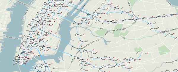
Mike Frumin’s map that show New York City subway ridership between 1905 to 2006 with sparklines for each station. Its great to see sparklines in use on a map, where the detail given by the sparkline is a kind of cartographic detail you can get lost in when looking at a map.
The general idea it that the history of subway ridership tells a story about the history of a neighborhood that is much richer than the overall trend.
[ iamtheweather powered by Wordpress And is definitely Not Plastic Bag ]