Tagged with opendtreetmap
United States in Powerlines
Posted June 19th, 2008 at 10:54 am. There are 0 comments..flickr-photo { border: none } .flickr-yourcomment { } .flickr-frame { text-align: left; padding: 3px; } .flickr-caption { font-size: 0.8em; margin-top: 0px; }
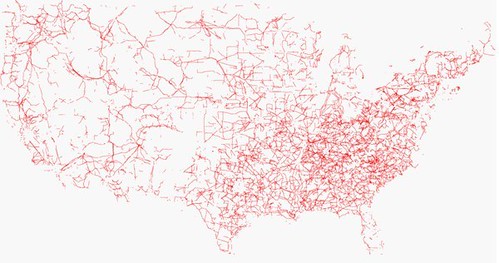
The systems of the distribution of power are depicted in this map from the Open Street Map Project. If you are in New York City on the weekend of June 28th and 29th there is a mapping party.
Previously, all the roads in the United States
[ iamtheweather powered by Wordpress And is definitely Not Plastic Bag ]